Early History
Glacial Lake Iroquois was a prehistoric proglacial lake that existed at the end of the last ice age approximately 13,000 years ago. The lake was essentially an enlargement of the present Lake Ontario that formed because the St. Lawrence River downstream from the lake was blocked by an ice sheet near the present Thousand Islands. The level of the lake was approximately 30 m (~100 ft) above the present level of Lake Ontario.
At its shoreline a mound of sand and gravel accumulated, creating a natural foot trail cutting through the forests and marshlands of Western New York where we now see the Ridge Road. Indigenous people utilized this trail in their early development of the Niagara Peninsula. The people who once resided here are most often referred to as Wendat meaning "dwellers on a peninsula;" however, their true names have been lost to history. The people who resided here made a choice to not take sides in the 1649 war between the Hurons and Iroquois. For this reason, the French named them Nation du Neutre, Neuter Nation or Neutrals in their texts.
The Iroquois started this conflict as a means to dominate the European trade markets of which the Huron people had become the favorite trading partners of the French. It began with small attacks that weakened the Huron’s food supplies. Once weakened, a rapid scorched earth attack commenced. Armed by their Dutch and English trading partners, the Iroquois destroyed several large tribal confederacies including the Mahicans (Mohicans), Huron (Wyandot), Neutral, Erie, Susquehannock (Conestoga) and northern Algonquins.
In 1788, an organization formed by Oliver Phelps and Nathaniel Gorham bought preemptive rights to six million acres of land in what is now western New York State from the Commonwealth of Massachusetts and the pre-emptive right to the title on the land from the Six Nations of the Iroquois Confederacy. Phelps and Gorham exhausted themselves trying to clear the title to the land and it defaulted back to the Commonwealth of Massachusetts. Robert Morris purchased 1.5 million acres from Massachusetts for 1.5 shillings per acre. Morris succeeded in extinguishing Native American title by means of the Treaty of Big Tree and subsequently sold 3.3 million acres west of the Genesee River in 1792-1793 to the Holland Land Company, a group of wealthy businessmen in Amsterdam.
From the company’s headquarters in Philadelphia, they hired Joseph Ellicott and sent him and one hundred and thirty men to begin surveying the land. Surveying was done by the transit method, which required line-of-sight measurements and used one hundred and fifty men to clear and gage the vast frontier lands, between March 1798 and October of 1800. They divided the tract into six-mile square townships, those divided into three hundred and twenty acre lots and the lots into one hundred- and twenty-acre tracts measured in metes and bounds that were marked by inscribed stones or natural features of the landscape.
In 1801 Joseph Ellicott platted Batavia to be the headquarters of his land office. This new settlement was to be located just ten miles from the Ganson Settlement, which was then the farthest settlement west of the Genesee River.
The first parcels were offered up for sale at the same time. The survey teams had cut some paths through forests and established camps along the way; however, most of the roads then were Indian trails and where no Indian trails were found, pioneers had to make their own paths. In 1801 land was selling for $2.75 an acre and purchasers were required to place at least ten percent down to their local land office. Often incentives were given to those first purchasers. These varied from being allowed to put less down to perhaps working off their debt by building a road, opening a sawmill, or any other action that would be necessary to further develop this western territory.
The pioneers had a dense forest to confront them as they located on their several farms. Many years prior the beavers had constructed dams to obstruct the flow of water in its natural course, so that three swamps were within, or contiguous to the town’s present borders. The one in the north part, called the big bear swamp, embraced hundreds of acres, one south of the Ridge Road flooded a large tract of land for the most part of the year, and one in the east, located principally on the Forsyth farm, though not as large, retained water like the previous ones until the hot days of summer, when the malaria that was generated from them caused fevers and ague that enfeebled every member of the community, so that at times hardly enough non inflicted people were left to care for the sick. In time, those dams were opened by state and private ditches from six to eight feet deep. The swamp land was thus reclaimed, and consequently the health of the people in a great measure assured.
The act of Legislature, passed March 11th, 1808, to form Niagara county from Genesee, include the following lines:
“And be it further enacted that the part of the county of Niagara lying north of the main stream of the Tonawanda creek, and of a line extending west from the mouth of said creek to the boundary line between the United States and the dominion of the King of Great Britain, be erected into a town by the name of Cambria; and that the first town meeting in the said town be held at the house of Joseph Hewitt…And be it further enacted, that so much of this act as relates to the forming of town, shall take effect from and after the day preceding the first Tuesday of April next.”
Tuesday, April 5th, 1808, according to the town records, “the freeholders and inhabitants of the town of Cambria, by the authority aforesaid, met in town meeting at the house of Joseph Hewitt; and Robert Lee, Esq., a justice of the peace in and for the county of Genesee, presided, superintending the same. The town meeting being thus organized, proceeded to the election of a town clerk. James Harrison was duly elected; Joseph Hewitt supervisor; Robert Lee, Benjamin Barton and Charles Wilber, commissioners of highways; Lemuel Cook, Silas Hopkins and John Dunn, assessors; Stephen Hopkins, collector; Philemon Baldwin and Alexander Haskin, constables; Enoch Hitchcock for the eastern district, and Thomas Hustler for the western, pound-masters.”
There is reason to admire the concert of action that prevailed among the first settlers, in forming and regulating communities. “Men in high estate” did not pride themselves on former position or favored condition, nor hesitate to become subordinates if services were required to advance the prosperity of all. Benjamin Barton, before in the position of sheriff, wielding power over all western New York, becomes a highway commissioner or pathmaster. Pater B. Porter stands in rank with him, for any duly imposed; also, Jonas Harrison, as an educated and qualified lawyer, the first established in the county, and for several terms the efficient town clerk. Wherever the most reliable men were found, they freely submitted and were freely used.
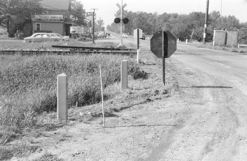
Molyneaux’s Corners
Molyneaux’s Corners has always been an important point in the Holland Purchase. Mr. Ellicott, supposedly influenced by frequent applications, instructed for a lot to be surveyed here before any other surveys were to be completed, hence the irregular lines of the lot, not corresponding with the section lines.
In order to meet the pressing necessity of shelter for such as were prospecting for locations a system of taverns was planned. Taverns then were civic centers, able to host all manners of public services and, when equipped with proper kitchens, were often the only means for early settlers to obtain a warm meal and a dry shelter while they constructed their own shelters. In 1801, Joseph Ellicott approached well respected tavern owners with offers for prime locations in the not-yet-settled frontier. These first stakeholders signed contracts agreeing to take ownership of such lands whenever they are able to be surveyed. David Klink, Philip Beach and John Forsyth were three pioneers known to sign such agreements in 1801.
David Klink accepted such an offer and for him Ellicott had surveyed a plot of seventy-four- and one-half acres where he assisted Klink to erect a log tavern. Klink paid $261.42 for the tract of land that would later be called Molyneaux’s Corners.
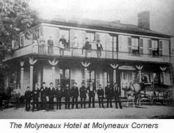
In 1809 John Gould purchased the Klink’s tavern and took over as proprietor. In 1811 he sold to one Odell, and he to Silas Hopkins in 1812. Not long after Hopkins, the property passed to William Molyneaux, who continued in possession, with the exception of during the War of 1812, up to his death in 1830. His sons, Charles, William, and Robert were in interest with him in conducting the tavern and the primitive log tavern was superseded by a large hotel in 1826.
The first and only store at Molyneaux’s Corners was established by Hamlin & White immediately after the close of the war; it was located in front of George Gould’s residence.
Many of the pioneers may be traced to the primitive burying-ground that arrests the attention of the most casual observer passing by a well-selected, quiet, rural spot on the west side of the ridge. Two British soldiers were killed in the Molyneux Tavern during the war and were the first laid in it after the Gains Militia marched in response to the invasion by Great Britain. The early pioneer Jesse Beach was the third.
Philip Beach and his family were also leading pioneers of Cambria.
Philip attempted to locate before his land could be surveyed. Mr. Ellicott, to encourage settlement, reportedly directed him to “stick a stake,” and promised to survey a piece for him, which he did, regardless of any other survey, and gave him possession.
In the spring of 1801, the Beach family’s tent was pitched on the bank of what would become Howell’s creek, by the side of the Indian trail they had been traversing for many days. At this point was built their log tavern to shelter reclaimers of the waste places and subduers of the forest.
Mr. Beach had become acquainted with the country by having been the earliest mail carrier from Batavia to Fort Niagara; employed by Ganson and Hosmer, who had the mail contract during the years 1799 and 1800.
It is said that he followed obscure Indian paths, directed by an Indian guide at that time. As there was no white man’s habitation to enter when night overtook him, the ground was his bed, the forest trees his covering, the sky his window to disclose the light of day. It was the diligent work of several days to complete one round trip. Relief from the arduous duty was only had by the voluntary aid of his brother Jesse.
Jesse and John Beech, with their families came the same season. Having lived in Scottsville for ten years prior, named for Vermont native Isaac Scott, father of Mrs. Jesse Beach.
The Beaches brought into the woods what they supposed would be a year’s ample supply of provisions. The draft of others upon them, who had not their means, or who failed to exercise their forethought, early exhausted their stores and to replenish them was not an easy undertaking. David, the eldest son of Jesse Beach, and some others, were sent back east for supplies. They made their way to Lake Ontario where they embarked in a small skiff and coasted along the southern shore to the mouth of the Genesee river, and thence proceeded to Scottsville. A cargo was laid in, and the return voyage was accomplished with long days and nights of fatigue.
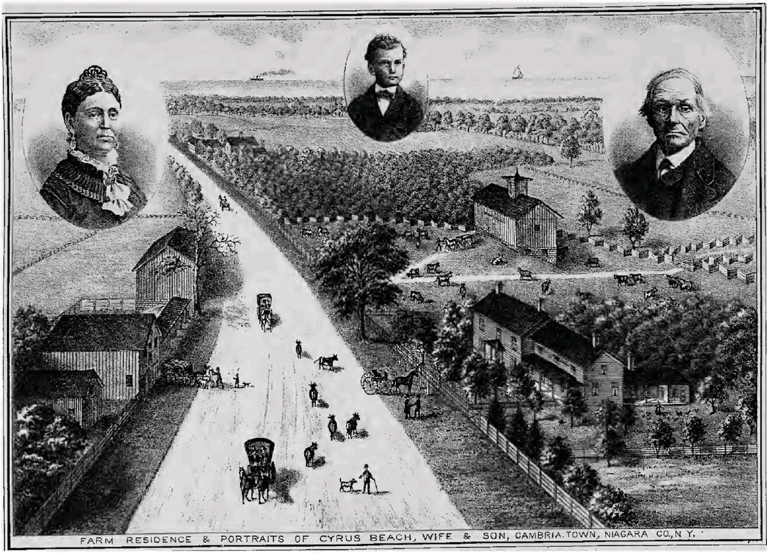
Philip Beach sold to Joseph Hewitt, who exchanged with William Howell for his farm on the Falls Road above Lewiston. Mr. Beach next located on the Sparrow Sage farm, which he sold to William Molyneaux, and settled next to what is now the See farm in Warren’s Corners. He finally located on the North Ridge, half a mile from the South Ridge. His brother Aaron Beach, remembered most for having spent eighteen months imprisoned in Montreal during the Revolutionary War. He relocated to the South Ridge in 1811 and North Ridge in 1815. On this farm, Cyrus Beach, while he was clearing, in a majority of the trees, mostly in the center, musket balls were found in the solid wood four inches from the outside, in large number, and also in a plowing the ground. A musket barrel was plowed up, containing a charge of powder.
Joseph Hewitt planted an orchard of the Beach farm, having set twenty-five apple trees purchased for twenty-five cents each from a man from Canada. He sold the farm to William Howell in 1808.
Glacial Lake Iroquois was a prehistoric proglacial lake that existed at the end of the last ice age approximately 13,000 years ago. The lake was essentially an enlargement of the present Lake Ontario that formed because the St. Lawrence River downstream from the lake was blocked by an ice sheet near the present Thousand Islands. The level of the lake was approximately 30 m (~100 ft) above the present level of Lake Ontario.
At its shoreline a mound of sand and gravel accumulated, creating a natural foot trail cutting through the forests and marshlands of Western New York where we now see the Ridge Road. Indigenous people utilized this trail in their early development of the Niagara Peninsula. The people who once resided here are most often referred to as Wendat meaning "dwellers on a peninsula;" however, their true names have been lost to history. The people who resided here made a choice to not take sides in the 1649 war between the Hurons and Iroquois. For this reason, the French named them Nation du Neutre, Neuter Nation or Neutrals in their texts.
The Iroquois started this conflict as a means to dominate the European trade markets of which the Huron people had become the favorite trading partners of the French. It began with small attacks that weakened the Huron’s food supplies. Once weakened, a rapid scorched earth attack commenced. Armed by their Dutch and English trading partners, the Iroquois destroyed several large tribal confederacies including the Mahicans (Mohicans), Huron (Wyandot), Neutral, Erie, Susquehannock (Conestoga) and northern Algonquins.
In 1788, an organization formed by Oliver Phelps and Nathaniel Gorham bought preemptive rights to six million acres of land in what is now western New York State from the Commonwealth of Massachusetts and the pre-emptive right to the title on the land from the Six Nations of the Iroquois Confederacy. Phelps and Gorham exhausted themselves trying to clear the title to the land and it defaulted back to the Commonwealth of Massachusetts. Robert Morris purchased 1.5 million acres from Massachusetts for 1.5 shillings per acre. Morris succeeded in extinguishing Native American title by means of the Treaty of Big Tree and subsequently sold 3.3 million acres west of the Genesee River in 1792-1793 to the Holland Land Company, a group of wealthy businessmen in Amsterdam.
From the company’s headquarters in Philadelphia, they hired Joseph Ellicott and sent him and one hundred and thirty men to begin surveying the land. Surveying was done by the transit method, which required line-of-sight measurements and used one hundred and fifty men to clear and gage the vast frontier lands, between March 1798 and October of 1800. They divided the tract into six-mile square townships, those divided into three hundred and twenty acre lots and the lots into one hundred- and twenty-acre tracts measured in metes and bounds that were marked by inscribed stones or natural features of the landscape.
In 1801 Joseph Ellicott platted Batavia to be the headquarters of his land office. This new settlement was to be located just ten miles from the Ganson Settlement, which was then the farthest settlement west of the Genesee River.
The first parcels were offered up for sale at the same time. The survey teams had cut some paths through forests and established camps along the way; however, most of the roads then were Indian trails and where no Indian trails were found, pioneers had to make their own paths. In 1801 land was selling for $2.75 an acre and purchasers were required to place at least ten percent down to their local land office. Often incentives were given to those first purchasers. These varied from being allowed to put less down to perhaps working off their debt by building a road, opening a sawmill, or any other action that would be necessary to further develop this western territory.
The pioneers had a dense forest to confront them as they located on their several farms. Many years prior the beavers had constructed dams to obstruct the flow of water in its natural course, so that three swamps were within, or contiguous to the town’s present borders. The one in the north part, called the big bear swamp, embraced hundreds of acres, one south of the Ridge Road flooded a large tract of land for the most part of the year, and one in the east, located principally on the Forsyth farm, though not as large, retained water like the previous ones until the hot days of summer, when the malaria that was generated from them caused fevers and ague that enfeebled every member of the community, so that at times hardly enough non inflicted people were left to care for the sick. In time, those dams were opened by state and private ditches from six to eight feet deep. The swamp land was thus reclaimed, and consequently the health of the people in a great measure assured.
The act of Legislature, passed March 11th, 1808, to form Niagara county from Genesee, include the following lines:
“And be it further enacted that the part of the county of Niagara lying north of the main stream of the Tonawanda creek, and of a line extending west from the mouth of said creek to the boundary line between the United States and the dominion of the King of Great Britain, be erected into a town by the name of Cambria; and that the first town meeting in the said town be held at the house of Joseph Hewitt…And be it further enacted, that so much of this act as relates to the forming of town, shall take effect from and after the day preceding the first Tuesday of April next.”
Tuesday, April 5th, 1808, according to the town records, “the freeholders and inhabitants of the town of Cambria, by the authority aforesaid, met in town meeting at the house of Joseph Hewitt; and Robert Lee, Esq., a justice of the peace in and for the county of Genesee, presided, superintending the same. The town meeting being thus organized, proceeded to the election of a town clerk. James Harrison was duly elected; Joseph Hewitt supervisor; Robert Lee, Benjamin Barton and Charles Wilber, commissioners of highways; Lemuel Cook, Silas Hopkins and John Dunn, assessors; Stephen Hopkins, collector; Philemon Baldwin and Alexander Haskin, constables; Enoch Hitchcock for the eastern district, and Thomas Hustler for the western, pound-masters.”
There is reason to admire the concert of action that prevailed among the first settlers, in forming and regulating communities. “Men in high estate” did not pride themselves on former position or favored condition, nor hesitate to become subordinates if services were required to advance the prosperity of all. Benjamin Barton, before in the position of sheriff, wielding power over all western New York, becomes a highway commissioner or pathmaster. Pater B. Porter stands in rank with him, for any duly imposed; also, Jonas Harrison, as an educated and qualified lawyer, the first established in the county, and for several terms the efficient town clerk. Wherever the most reliable men were found, they freely submitted and were freely used.
Molyneaux’s Corners
Molyneaux’s Corners has always been an important point in the Holland Purchase. Mr. Ellicott, supposedly influenced by frequent applications, instructed for a lot to be surveyed here before any other surveys were to be completed, hence the irregular lines of the lot, not corresponding with the section lines.
In order to meet the pressing necessity of shelter for such as were prospecting for locations a system of taverns was planned. Taverns then were civic centers, able to host all manners of public services and, when equipped with proper kitchens, were often the only means for early settlers to obtain a warm meal and a dry shelter while they constructed their own shelters. In 1801, Joseph Ellicott approached well respected tavern owners with offers for prime locations in the not-yet-settled frontier. These first stakeholders signed contracts agreeing to take ownership of such lands whenever they are able to be surveyed. David Klink, Philip Beach and John Forsyth were three pioneers known to sign such agreements in 1801.
David Klink accepted such an offer and for him Ellicott had surveyed a plot of seventy-four- and one-half acres where he assisted Klink to erect a log tavern. Klink paid $261.42 for the tract of land that would later be called Molyneaux’s Corners.
In 1809 John Gould purchased the Klink’s tavern and took over as proprietor. In 1811 he sold to one Odell, and he to Silas Hopkins in 1812. Not long after Hopkins, the property passed to William Molyneaux, who continued in possession, with the exception of during the War of 1812, up to his death in 1830. His sons, Charles, William, and Robert were in interest with him in conducting the tavern and the primitive log tavern was superseded by a large hotel in 1826.
The first and only store at Molyneaux’s Corners was established by Hamlin & White immediately after the close of the war; it was located in front of George Gould’s residence.
Many of the pioneers may be traced to the primitive burying-ground that arrests the attention of the most casual observer passing by a well-selected, quiet, rural spot on the west side of the ridge. Two British soldiers were killed in the Molyneux Tavern during the war and were the first laid in it after the Gains Militia marched in response to the invasion by Great Britain. The early pioneer Jesse Beach was the third.
Philip Beach and his family were also leading pioneers of Cambria.
Philip attempted to locate before his land could be surveyed. Mr. Ellicott, to encourage settlement, reportedly directed him to “stick a stake,” and promised to survey a piece for him, which he did, regardless of any other survey, and gave him possession.
In the spring of 1801, the Beach family’s tent was pitched on the bank of what would become Howell’s creek, by the side of the Indian trail they had been traversing for many days. At this point was built their log tavern to shelter reclaimers of the waste places and subduers of the forest.
Mr. Beach had become acquainted with the country by having been the earliest mail carrier from Batavia to Fort Niagara; employed by Ganson and Hosmer, who had the mail contract during the years 1799 and 1800.
It is said that he followed obscure Indian paths, directed by an Indian guide at that time. As there was no white man’s habitation to enter when night overtook him, the ground was his bed, the forest trees his covering, the sky his window to disclose the light of day. It was the diligent work of several days to complete one round trip. Relief from the arduous duty was only had by the voluntary aid of his brother Jesse.
Jesse and John Beech, with their families came the same season. Having lived in Scottsville for ten years prior, named for Vermont native Isaac Scott, father of Mrs. Jesse Beach.
The Beaches brought into the woods what they supposed would be a year’s ample supply of provisions. The draft of others upon them, who had not their means, or who failed to exercise their forethought, early exhausted their stores and to replenish them was not an easy undertaking. David, the eldest son of Jesse Beach, and some others, were sent back east for supplies. They made their way to Lake Ontario where they embarked in a small skiff and coasted along the southern shore to the mouth of the Genesee river, and thence proceeded to Scottsville. A cargo was laid in, and the return voyage was accomplished with long days and nights of fatigue.
Philip Beach sold to Joseph Hewitt, who exchanged with William Howell for his farm on the Falls Road above Lewiston. Mr. Beach next located on the Sparrow Sage farm, which he sold to William Molyneaux, and settled next to what is now the See farm in Warren’s Corners. He finally located on the North Ridge, half a mile from the South Ridge. His brother Aaron Beach, remembered most for having spent eighteen months imprisoned in Montreal during the Revolutionary War. He relocated to the South Ridge in 1811 and North Ridge in 1815. On this farm, Cyrus Beach, while he was clearing, in a majority of the trees, mostly in the center, musket balls were found in the solid wood four inches from the outside, in large number, and also in a plowing the ground. A musket barrel was plowed up, containing a charge of powder.
Joseph Hewitt planted an orchard of the Beach farm, having set twenty-five apple trees purchased for twenty-five cents each from a man from Canada. He sold the farm to William Howell in 1808.
Source: History of Niagara County, N.Y, with illustrations descriptive of its scenery, private residences, public buildings, fine blocks, and important manufactories, and portraits of old pioneers and prominent residents. New York: Sanford & Co., 36 Vesey Street.
William Howell and wife had come from New Jersey by Indian paths, through southern New York via Painted Post to Batavia and then by the Niagara Road, intersecting the ridge at Warren’s Corners, and following it to Lewiston. Four horses carried the couple, bedding, clothing, and provisions. They did not see a house after passing he Genesee river until they reached the Niagara Road. The night before coming to to the latter they made camp on the westerly bank of a branch of Eighteen-mile creek, where the Stone Road now passes to the ridge. Turning out the horses after securely hampering them, upon a favorable spot of wild grass, they cooked supper and lodged under a large black walnut tree. Continuing the journey, the next morning, they traversed the ridge, crossed the Niagara river at Lewiston, in bark canoes, swimming their horses, and landed to look for an abiding place in Canada. Before leaving their last camp, they enjoyed the relish of some Jersey apples, and planted the seeds on the campground, the product of which remained for many years afterwards. They shortly returned from Canada, and located two miles up the river from Niagara Falls, and soon after on the Hewitt farm, next to his residence on the ridge. “My Mother said,” remarked Mrs. Cook, “when the mountain months would pass away without seeing a white man or woman.” Mr. Howell built the first saw-mill on Howell’s creek.
There is a divergence of an arm of the Ridge Road at Molyneaux’s Corners. For three miles it takes a course to leave a flatiron shape between the two ridges, varying in width from the eastern point to near a mile at the western extremity, and embraces some of the most desirable farming land in the county. In a state of nature, as the floods left the perpetual deposits, it was heavily timbered, wet land, or a series of marsh and swamps.
Reuben Hurd was the first to break into the wilderness and chose a location on so desirable a spot which occurred sometime around 1805. James Barnes located in 1810, taking an article from the Holland Land Company for three hundred and fifty-seven acres at $2.50 per acre, advancing only a small payment. Drafted into the service in 1813, he had but little opportunity to make improvements. He was taken prisoner at the battle of Newark and never returned.
Nathaniel Cook came from Onondaga county to Lockport where he engaged with John Gilbert, contractor on the upper or last section of the Erie Canal, as a purchaser of supplies. He remained until the canal was finished in 1824 and then purchased land from the Holland Land Company, paying $5.50 per acre for one hundred and nineteen acres. “It was,” he said, “all wet and swamp, hard to subdue in consequence of what was called cat-holes. I had to contend with a beaver dam for as much as ten years, when the work of the animal was still visible. Could only get fifty cents per bushel for my wheat, the only resource to pay for my land, that I had run in debt for.” He later told the story that a man chopping wood for him, on the south side of the North Ridge, found in the body of a white oak, eighteen inches in diameter, a common sized vest button, embedded in the solid timber, four inches from the surface; there was no other mark but a dead spot where it lay. Examined by a silversmith in Lockport, it was pronounced a fair quality of gold. It was only battered on one side.
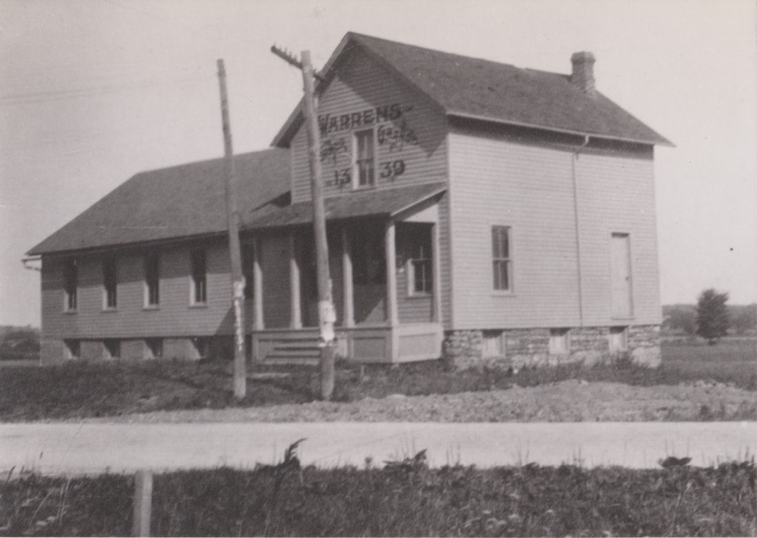
Warren’s Corners
John Forsyth signed an article of agreement with Joseph Ellicott on February 28, 1801 to purchase a lot along the speculative Queenstown Road whenever said road should be laid out. In 1805, he moved his family to what would become Cambria. His wife was among the first pioneers of the “Genesee country,” a descendent of the Ganson family, prominent in local history. She, pregnant and with two young children, drove a covered wagon pulled by oxen. Tied to one side was a plow and on the other a coop with six chickens. The family cow was tied to the back of the cart. Following them was John on horseback leading three or four sheep and the same number of hogs. The trip took them five or six days. When Mr. Forsyth located on the ridge there were but three or four settlers between the place where he had come from, Dunham’s Grove, and where he planted his stake. East of his stake there was no neighbor nearer than beyond the “eleven-mile woods” (Morehouse’s Corners). The widow Forsyth wrote, “we brought in a few sheep with us; they were the only ones in the neighborhood; they became the especial object of the wolves. Coming out of the Wilson swamp nights, their howling would be terrific. Two years after we came in, with my then small children, one day when I heard the sheep bleating, I went out to see what the matter was. A large wolf had badly wounded a sheep. As I approached him he left the sheep, and walked off snarling, as if reluctant to leave his prey. I went to my nearest neighbor, Mr. Stoughton, to come and dress the sheep. It was three-fourths of a mile, through the woods. On my way a large grey fox crossed the road ahead of me. Returning with me neighbor, a large bear slowly crossed the road in sight of us.”
The first burial grounds of the town was established at the Forsyth’s tavern when a young passerby died at the tavern. The second internment there is believed to have been John Forsyth in 1812.
Harry Steadman came from Lima, Livingston County, in 1807 or 1808, and purchased one hundred and ninety acres from the Holland Land Company, on the north side of the eastern terminus of the Ridge Road, where the turnpike intersects it. Her father boarded the hands employed in building the log road over the swamp, between Wright’s and Warren’s; it was said that they looked like an army when coming to his log house. There were daily calls upon Mr. Steadman, to help someone out who got a team stuck in the mud.
John Haner located on the Forsyth farm in 1809. He and his family came from Pennsylvania. He reportedly built the best log house in this vicinity at that time, made of hewed oak logs, two stores high, twenty-four by thirty feet wide, and covered with oak tile. It was used for a dwelling for many years.
Joseph Carlton was a native of Derry, New Hampshire before settling on his farm at Warren’s Corners which occurred in 1810. He was the first wagon maker that set up shop in the country. Though from birth deprived of his left hand, he used the tools to do the intricate work imposed upon him with precision and dexterity. He continued the business for a number of years until disabled by paralysis, of which he survived a number of years.
Colonel Andrew Sutherland, with his wife, Naomi, removed to Cambria in 1810, and bought land on the Ridge Road in Warren’s Corners. During the war of 1812 he with his family returned to Vermont, their former home. He served in the army during its continuance, and was promoted to the rank of colonel. When peace was declared the family again occupied the farm. At the organization of the first militia regiment in the county about the year 1823, he was appointed its colonel and served in that position a number of years.
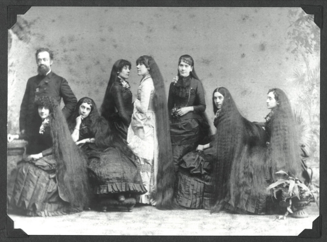
The Seven Sutherland Sisters was a singing group which included the seven daughters of Fletcher and Mary Sutherland. They appeared with Barnum and Bailey's from the early 1880s to the early 1900s. Their distinguishing feature was their long hair; publicity about the length and texture of their hair enabled the Sutherlands to create a successful line of patent medicine hair and scalp care products.
Thomas Mighells, a native of Deerfield, Mass., came from Livingston County, N. Y., with his family and settled in March of 1810. He was a man said to be well calculated for pioneer life, progressive and persevering. Soon after the war he built a saw mill near the corners. It was located on the south branch of the Eighteen Mile Creek about a hundred rods south of the corners. A relic of the old dam was to be observed for a number of years. The school boys called it the swimming pond. He also established an ashery for the manufacture of potash, and a tannery a short distance from the sawmill on the same stream, but did not continue in the business but a few years. He was a boot and shoe maker by trade and in the latter years of his life he did a considerable business of that kind.
Samuel Capen and his family came from Windsor, VT., in 1807. They sojourned on the Slayton Settlement road two or three years. The Slaytons who had formerly settled there were near relatives and came from the same town in Vermont. They moved and located on a farm near Molyneaux’s Corners on the farm subsequently owned by the Hon. Hiram McNeil. Mr. Capen’s brother-in-law, Jonathan Sabin, purchased at the same time on the south side of the Ridge road. In 1815 Mr. Capen bought a large farm north and east of the corners. He built a double log house on the hill opposite where John Haner lived. After the final adjustment of the towns, it lay part in Newfane and Wilson.
When the British and their allies invaded Cambria, most residents left their farmsteads behind and fled west. The Widow Forsyth sent her two sons with the fleeing residents and remained behind with her two daughters.
Sargent Ezra Warren, with the Vermont Calvary, was stationed there for a time and the United States used the Forsyth’s tavern as a base and provisions depot for the duration of the war.
After the war ended and the Treaty of Ghent returned the Niagara Frontier to the United States, Ezra left his home in Vermont and married the Widow Forsyth. He soon afterwards constructed a schoolhouse and general store at the corners, thenceforth known as Warren’s Corners.
Artemus Baker, who was the first physician in the town, located at Warren’s Corners in 1815.
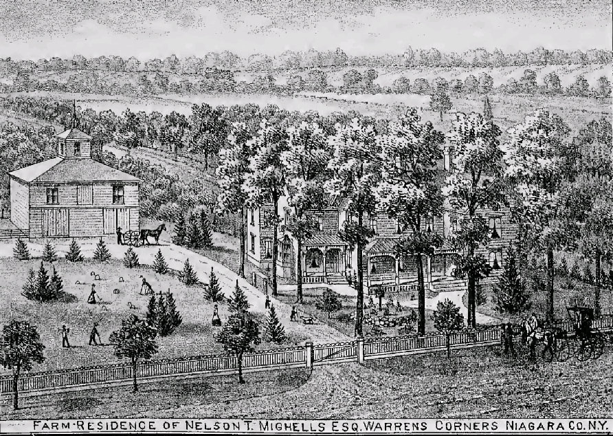
David Adams came from New Hampshire in 1815 and settled at the corners as the first village blacksmith. His first shop was located on the corner where the fine residence of the late Nelson T Mighels later stood. In the spring of 1824, he returned to his native state and was married to Miss Mary Corning. He thence returned to Cambria and bought the farm then occupied by John Sipson who had previously run a blacksmith shop on the premises. The farm was three-fourths of a mile east of the corners on the Turnpike road in the town of Newfane. In 1835, he purchased a lot of three acres of Ezra Warren at the corners and erected a house and shop on it and carried on the business for a number of years. Many inhabitants long remembered the stanchions used by him for the purpose of shoeing oxen. They were made of a heavy wooden frame, arranged with rollers at the top with strong leather girths attached to raise them off their feet, then bind their legs to side girts, when the shoeing could be done with safety if not with ease.
There is a divergence of an arm of the Ridge Road at Molyneaux’s Corners. For three miles it takes a course to leave a flatiron shape between the two ridges, varying in width from the eastern point to near a mile at the western extremity, and embraces some of the most desirable farming land in the county. In a state of nature, as the floods left the perpetual deposits, it was heavily timbered, wet land, or a series of marsh and swamps.
Reuben Hurd was the first to break into the wilderness and chose a location on so desirable a spot which occurred sometime around 1805. James Barnes located in 1810, taking an article from the Holland Land Company for three hundred and fifty-seven acres at $2.50 per acre, advancing only a small payment. Drafted into the service in 1813, he had but little opportunity to make improvements. He was taken prisoner at the battle of Newark and never returned.
Nathaniel Cook came from Onondaga county to Lockport where he engaged with John Gilbert, contractor on the upper or last section of the Erie Canal, as a purchaser of supplies. He remained until the canal was finished in 1824 and then purchased land from the Holland Land Company, paying $5.50 per acre for one hundred and nineteen acres. “It was,” he said, “all wet and swamp, hard to subdue in consequence of what was called cat-holes. I had to contend with a beaver dam for as much as ten years, when the work of the animal was still visible. Could only get fifty cents per bushel for my wheat, the only resource to pay for my land, that I had run in debt for.” He later told the story that a man chopping wood for him, on the south side of the North Ridge, found in the body of a white oak, eighteen inches in diameter, a common sized vest button, embedded in the solid timber, four inches from the surface; there was no other mark but a dead spot where it lay. Examined by a silversmith in Lockport, it was pronounced a fair quality of gold. It was only battered on one side.
Warren’s Corners
John Forsyth signed an article of agreement with Joseph Ellicott on February 28, 1801 to purchase a lot along the speculative Queenstown Road whenever said road should be laid out. In 1805, he moved his family to what would become Cambria. His wife was among the first pioneers of the “Genesee country,” a descendent of the Ganson family, prominent in local history. She, pregnant and with two young children, drove a covered wagon pulled by oxen. Tied to one side was a plow and on the other a coop with six chickens. The family cow was tied to the back of the cart. Following them was John on horseback leading three or four sheep and the same number of hogs. The trip took them five or six days. When Mr. Forsyth located on the ridge there were but three or four settlers between the place where he had come from, Dunham’s Grove, and where he planted his stake. East of his stake there was no neighbor nearer than beyond the “eleven-mile woods” (Morehouse’s Corners). The widow Forsyth wrote, “we brought in a few sheep with us; they were the only ones in the neighborhood; they became the especial object of the wolves. Coming out of the Wilson swamp nights, their howling would be terrific. Two years after we came in, with my then small children, one day when I heard the sheep bleating, I went out to see what the matter was. A large wolf had badly wounded a sheep. As I approached him he left the sheep, and walked off snarling, as if reluctant to leave his prey. I went to my nearest neighbor, Mr. Stoughton, to come and dress the sheep. It was three-fourths of a mile, through the woods. On my way a large grey fox crossed the road ahead of me. Returning with me neighbor, a large bear slowly crossed the road in sight of us.”
The first burial grounds of the town was established at the Forsyth’s tavern when a young passerby died at the tavern. The second internment there is believed to have been John Forsyth in 1812.
Harry Steadman came from Lima, Livingston County, in 1807 or 1808, and purchased one hundred and ninety acres from the Holland Land Company, on the north side of the eastern terminus of the Ridge Road, where the turnpike intersects it. Her father boarded the hands employed in building the log road over the swamp, between Wright’s and Warren’s; it was said that they looked like an army when coming to his log house. There were daily calls upon Mr. Steadman, to help someone out who got a team stuck in the mud.
John Haner located on the Forsyth farm in 1809. He and his family came from Pennsylvania. He reportedly built the best log house in this vicinity at that time, made of hewed oak logs, two stores high, twenty-four by thirty feet wide, and covered with oak tile. It was used for a dwelling for many years.
Joseph Carlton was a native of Derry, New Hampshire before settling on his farm at Warren’s Corners which occurred in 1810. He was the first wagon maker that set up shop in the country. Though from birth deprived of his left hand, he used the tools to do the intricate work imposed upon him with precision and dexterity. He continued the business for a number of years until disabled by paralysis, of which he survived a number of years.
Colonel Andrew Sutherland, with his wife, Naomi, removed to Cambria in 1810, and bought land on the Ridge Road in Warren’s Corners. During the war of 1812 he with his family returned to Vermont, their former home. He served in the army during its continuance, and was promoted to the rank of colonel. When peace was declared the family again occupied the farm. At the organization of the first militia regiment in the county about the year 1823, he was appointed its colonel and served in that position a number of years.
The Seven Sutherland Sisters was a singing group which included the seven daughters of Fletcher and Mary Sutherland. They appeared with Barnum and Bailey's from the early 1880s to the early 1900s. Their distinguishing feature was their long hair; publicity about the length and texture of their hair enabled the Sutherlands to create a successful line of patent medicine hair and scalp care products.
Thomas Mighells, a native of Deerfield, Mass., came from Livingston County, N. Y., with his family and settled in March of 1810. He was a man said to be well calculated for pioneer life, progressive and persevering. Soon after the war he built a saw mill near the corners. It was located on the south branch of the Eighteen Mile Creek about a hundred rods south of the corners. A relic of the old dam was to be observed for a number of years. The school boys called it the swimming pond. He also established an ashery for the manufacture of potash, and a tannery a short distance from the sawmill on the same stream, but did not continue in the business but a few years. He was a boot and shoe maker by trade and in the latter years of his life he did a considerable business of that kind.
Samuel Capen and his family came from Windsor, VT., in 1807. They sojourned on the Slayton Settlement road two or three years. The Slaytons who had formerly settled there were near relatives and came from the same town in Vermont. They moved and located on a farm near Molyneaux’s Corners on the farm subsequently owned by the Hon. Hiram McNeil. Mr. Capen’s brother-in-law, Jonathan Sabin, purchased at the same time on the south side of the Ridge road. In 1815 Mr. Capen bought a large farm north and east of the corners. He built a double log house on the hill opposite where John Haner lived. After the final adjustment of the towns, it lay part in Newfane and Wilson.
When the British and their allies invaded Cambria, most residents left their farmsteads behind and fled west. The Widow Forsyth sent her two sons with the fleeing residents and remained behind with her two daughters.
Sargent Ezra Warren, with the Vermont Calvary, was stationed there for a time and the United States used the Forsyth’s tavern as a base and provisions depot for the duration of the war.
After the war ended and the Treaty of Ghent returned the Niagara Frontier to the United States, Ezra left his home in Vermont and married the Widow Forsyth. He soon afterwards constructed a schoolhouse and general store at the corners, thenceforth known as Warren’s Corners.
Artemus Baker, who was the first physician in the town, located at Warren’s Corners in 1815.
David Adams came from New Hampshire in 1815 and settled at the corners as the first village blacksmith. His first shop was located on the corner where the fine residence of the late Nelson T Mighels later stood. In the spring of 1824, he returned to his native state and was married to Miss Mary Corning. He thence returned to Cambria and bought the farm then occupied by John Sipson who had previously run a blacksmith shop on the premises. The farm was three-fourths of a mile east of the corners on the Turnpike road in the town of Newfane. In 1835, he purchased a lot of three acres of Ezra Warren at the corners and erected a house and shop on it and carried on the business for a number of years. Many inhabitants long remembered the stanchions used by him for the purpose of shoeing oxen. They were made of a heavy wooden frame, arranged with rollers at the top with strong leather girths attached to raise them off their feet, then bind their legs to side girts, when the shoeing could be done with safety if not with ease.
Source: History of Niagara County, N.Y, with illustrations descriptive of its scenery, private residences, public buildings, fine blocks, and important manufactories, and portraits of old pioneers and prominent residents. New York: Sanford & Co., 36 Vesey Street.
The Cold Summer- If the years of the war of 1812 were a great source of anxiety and unrest to the few families that tarried on their farms until its close, the years of 1816 and 17, was remembered long after as the year of want and destitution, the like of which they never realized before or since. It was called and remembered years after as the cold season. Quite heavy frosts occurred in nearly if not quite every month through the Spring and Summer season, killing fruit, vegetables and grain, so that but a meager supply was saved. Before the year was out and another crop harvested, wheat and corn brought $3 a bushel, with but a stinted amount of money to purchase it with. It taxed the ingenuity of the pioneer and his wife to provide for wants of their families. A good chunk of pork would pass from one neighbor to another, that if might be used to season the pot of greens that made the early dish in the spring, until its virtue was exhausted. Grain before it was matured was plucked and boiled to satisfy the wants of hunger. Cattle were kept alive by the browse they got from fallen trees. Never did the return of a bountiful crop in 1817 receive a more cordial welcome, as it cheered the hearts and gladdened the homes of the new settlers.
Jasiah Talbert was a native of Massachusetts. Previous to coming to Warren’s Corners he married Miss Goodell, sister to Rev. William Goodell, D. D., who spent the most of his life as a missionary in Turkey. He located on the farm west of the Forsyth estate in 1817, built quite a large frame house and barn and commenced keeping of a tavern. He discontinued the business after two or three years and in 1824 sold the farm to Henry Snyder and Soloman Freer and purchased one contiguous on the north side of the road, building the house later belonging to the Tracy Estate. A few years after the deaths of Mr. and Mrs. Talbert the land was divided and sold by the executor for homesteads to those that held farms in the town of Wilson adjoining the property.
Alexander Gunn married Miss Betsy Adamns of Gorham, Ontario County, N. Y., in 1818. Soon after, they came and settled on a farm contiguous to the corners. In 1819 he erected the pioneer log cabin, but did not occupy it but three or four years. Bears coming from the mountain ravines destroyed his small patches of corn and sacked his pigpens. The foxes filched away their poultry and in connection with their marauding, the rattlesnakes were so numerous that it was dangerous for a person to venture out in the warm days of July and August without being well protected, as well as cautious. At times they would stealthily crawl into the house and create panic. Principally for these reasons they availed themselves of the first opportunity to sell the place to Mr. Howe and move back to Ontario County.
Isaac Warren, a cousin of Ezra Warren, was a native of Vermont. He settled on the farm of the estate of the late Robert Wilson on the turnpike road, one mile east of the corners, in 1819. He worked and improved the farm a number of years. Being a tailor by trade he devoted much of his time in cutting and making men’s apparel as most clothing was made to order in those days.
Henry Snyder married Polly Adamns of Ontario County, N. Y., where they both resided a number of years. In 1826 he bought the farm that Josiah Talbert had settled on. Mr. Snyder was a man well appreciated by his neighbors, as well as the people in the town where he lived. He served the town of Cambria as its supervisor one or two terms, 1846 and 7, and held other responsible positions in the gift of his townsmen.
The first established religious organization at Warren’s Corners was a class of Methodists, formed by the then young circuit preacher John Copeland. Ira Bronson was on the circuit at the same time. Rev. Mr. Fillmore was the presiding elder. A small church was erected in 1825, which the presiding brick church replaced, at a cost of $2,300. Ezra Warren donated the land and a large sum of money.
Andrew Budd, born in Kidnerhook in 1816, moved to Cambria in 1843, locating near Slocum’s tavern, then bought ninety-nine acres on the Ridge Road. The present graveyard near his place was originally a part of his farm.
Cambria Center
The earlies settlers at Cambria Center and vicinity were Benjamin and Suchel Silly, Peter Nearpass, William Scott, Enoch Hatch, Asel Muroy, David Waters and one Crowell. They formed the majority of the community previous to 1812.
William Scott purchased from the Holland Land Company five hundred acres, located at the center of Cambria, paying but a small advance. He cleared sixty acres the first season and built a tavern. The Scotts fled to Livingston County during the War of 1812 and returned afterwards.
Source: History of Niagara County, N.Y, with illustrations descriptive of its scenery, private residences, public buildings, fine blocks, and important manufactories, and portraits of old pioneers and prominent residents. New York: Sanford & Co., 36 Vesey Street.
John Gould purchased 240 acres from Nearpass. He early became one of the largest grain growers and fruit producers in the county and opened his home as a public house. Locals wrote of seeing Lafayette standing in the west room, greeted by all ages and both sexes, the landlord’s animated bearing showing his appreciation of being honored by so distinguished a guest.
Christopher Howder purchased from the Holland Company one hundred and fifty acres in 1812, one and a half miles east of Cambria Center. Adam Houstater located in 1813 near Howder, purchasing of him.
Pomeroy Oliver moved to Cambria in the summer of 1815, and cleared a piece of land, later William Mackey’s farm. In 1816, Joh Hitchcock settled on the farm later owned by Josiah Balliet and Mrs. Douglas. The Mountain Road, from near the Cold Springs in Lockport to the Deacon Chamberlain farm, was then only defined by marked trees, and had not been cut out. John Ingersoll and Jason Lane settled on the part of lot 20 north of Daniel Oliver; Pomeroy Oliver on the same lot under the mountain ridge, on a road now discontinued. Lot 28, west of lot 20, was settled by Russel Weaver and Joshua Cowell some time previous to 1810; Weaver locating on the farm later owned by his sons-in-law, D. W. Bristol and J.S. Hyman, and Cowell on land later occupied by William Hoover and James Thrall. In 1810 Philo Cowell located on what was later the farm of Hiram Richardson.
William Campbell located in 1817 and purchased of Eastman located two miles east of the Center, on the stone road leading to Lockport and in 1821, purchased of John Howder fifty acres.

Source: History of Niagara County, N.Y, with illustrations descriptive of its scenery, private residences, public buildings, fine blocks, and important manufactories, and portraits of old pioneers and prominent residents. New York: Sanford & Co., 36 Vesey Street.
Source: History of Niagara County, N.Y, with illustrations descriptive of its scenery, private residences, public buildings, fine blocks, and important manufactories, and portraits of old pioneers and prominent residents. New York: Sanford & Co., 36 Vesey Street.
Mrs. Fanny Longmate was recorded as saying that she and her husband, Daniel P. Oliver, located on the mountain ridge, four miles west of Lockport, in 1817. They followed a woods path from Warren’s Corners, with a horse team, until they reached the mountain. Not able to to get any further with the team, each took as much of the scant household effects as they could carry up the ledge. A chest made the most trouble, but it had to be taken, as they had no other table to eat from. Their log house was without a door or window. Two acres of land had been partially cleared. The neighbors west were John Miles, Hezekiah Hill and Elijah Smith; east, Coonrod Keyser. Mrs. Longmate’s father, Samuel Faxon, located on the road leading from the mountain to the railroad junction in 1820.
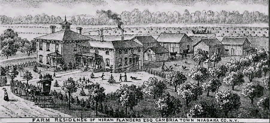
Jacob Flanders, from New Hamshire, bought of Elias Rose in 1820 one hundred and fifty acres, two and three-fourths miles west of the Center, and afterward purchased of the same gentleman the farm and stone grist-mill on the mountain east of Pekin.
Jacob Flanders, from New Hamshire, bought of Elias Rose in 1820 one hundred and fifty acres, two and three-fourths miles west of the Center, and afterward purchased of the same gentleman the farm and stone grist-mill on the mountain east of Pekin.
Source: History of Niagara County, N.Y, with illustrations descriptive of its scenery, private residences, public buildings, fine blocks, and important manufactories, and portraits of old pioneers and prominent residents. New York: Sanford & Co., 36 Vesey Street.
The first burial-ground was donated by William Campbell, and was known as the “Campbell burial-ground.” It was located on the Lockport stone road, one mile east of the Center. The second established is upon an elevated slope of the mountain ridge, a short distance south of the Corners; the land was a gift of William Scott.
The First Congregational Church of Cambria was organized in the year 1817, by Rev. David M. Smith, the pastor of the then Congregational Church of Lewiston. The original members were Josiah Owen, Susan Owen, Thomas Chamberlain, Jonas Chamberlain, Rachel Mills, and Hannah Crocker. In one year, their numbers had increased to 23.
It was through Mr. Smith that the Holland Land Company granted one hundred acres of land to this church as being the first organized church in Cambria. The land was situated in what is now the town of Lockport, near the present city limits. In 1827 it was sold by vote of the society, and the avails applies to the purchase of land nearer the center of the town.
The church had no resident pastor till 1827 and had only occasional preaching; at first by Rev. James C. Cram, who was the missionary of the American Board of Foreign Missions to the Tuscarora Nation, on their reservation, a little west of the town.
On the 7th day of May, 1824, the ecclesiastical society in connection with the church was formally organized by the adoption of a constitution. Josiah Owen was the first chairman of the society meetings, and Eliakim Hammond, Wiley Bancroft, Joash Taylor, Luther Crocker, Thomas Chamberlain and John Miles Jr. were trustees, with Thomas Webber as clerk and William Scott as treasurer.
Previously to 1836 the church had no house of worship. Meetings were geld in the schoolhouse or in private houses, according to convivence, and during the ministry of Rev. Hiram Hasey, previously to the erection of their church edifice and by the generosity of William Scott, they occupied the hall of his tavern at Cambria Center for all church meetings. At length, however, they erected a house of worship, and dedicated it on March 1st, 1836. This they occupied until October 1877. At that time the society, at a special meeting appointed for the purpose, resolved to remodel and modernize the meeting-house. The work was carried on and completed during the following winter, and on April 2, 1878, the new church was dedicated with appropriate services; Rev. Myron Adams, of Rochester, preaching the sermon, and Rev. I. R. Bradnack, a former pastor, offering the dedicatory prayer. The entire cost of remodeling the house was $4,400. The building was raised so as to allow of a good basement for various church purposes; the galleries in the main audience room removed and a vestibule built in the front, so that the present audience room has a seating capacity of three hundred and fifty people. The finish and furnishings are such as to do credit to the church and society.
The southwest part of the town was next in order of settlement. In 1809 John Carney purchased of the Holland Land Company five hundred acres. It encompassed all of the site of Pekin on the east side of the dividing line between Lewiston and Cambria.
Jairus Rose was the next settler, coming from Canandaigua and locating in 1811. His first purchase of the Holland Land Company was six hundred acres, at $4.50 per acre, to which he soon added at $5 per acre enough to make two thousand acres, which would now include the extreme southwest corner of Cambria and southeast corner of Lewiston, being lots 17, 25, 26, 31 and others. He brought his family by ox cart and a one-horse wagon. It took them just over a week with the help of three hired men to make the journey. They came by the way of Rochester, on the Ridge Road to Dickersonville, where the family stopped with a man by the name of Harris, while Rose and his men advanced and put up a log house in just three days. The way had to be cut from Dickersonville up to the mountains, to the small open spot in the woods that indicated the beginning of a proposed road. The fields, in a state of nature, were stocked with forty head of cattle, that had before them a hard winter with the prospect of having to live on twigs of birch and soft maple. There was considerable value in pine timber on the purchase, that was relied upon for several years for building purposes. In 1813 Mr. Rose sowed two acres with apple seeds, thus starting the first nursery in the county. When fit for selling, they were sold for twelve cents each, and taken in all directions to start the first orchards in the county.
In the Indian foray upon the Niagara border in 1813 Mr. Rose was made a prisoner; his horse was taken from him and he was stripped of all of his clothing, except shirt, pantaloons and boots. While his captors were taking off his overcoat, he succeeded, unobserved, in changing his pocket book, containing $400, from the side pocket to his bosom, whence it luckily passed into his boots, which proved to be a safe deposit. Two Indians, one on each side, locked arms with the captive, forcing a slow run the entire five miles to Lewiston, and often accelerating his speed by raps over the head with the handle of a tomahawk and the ramrods of their guns. The party crossed into Canada, where a British government agent by the name of Nellis tried to buy Rose. Three times the bargain was completed and a hundred dollars paid, and as often the Indians failed to give up the prisoner, clamoring for the death of the “Yankee,” whom Nellis was concealing in a garret, denying his whereabouts. Finally, extorting another hundred, the Indians went off and got drunk. Then they returned and threatened the life of Nellis if the prisoner was not surrendered to them. He was not, however, after six weeks confinement, receiving his food during the time through a scuttle, Rose was sent in care of a private escort of soldiers to Buffalo, from where he joined his family in Canandaigua. They returned after the war and resumed development of their lands.
Myron Orton was born September 20, 1784. He was married to Mary Hoyt, of St. Albans, Vt., in 1811, and moved into St. Lawrence County, N.Y., where he practiced medicine until the War of 1812 caused him to flee to Middlebury. In March of 1815, he moved to Cambria. He was one of the founders of the Niagara County Medical Society and then in later years devoted himself to agricultural pursuits.
William Crosier was a leading citizen for over sixty years. He was a pioneer school teacher in the town of Cambria, the district of his labor for several years spreading over a large portion of the town. He located in 1821 on a farm one and a half miles east of Pekin village.
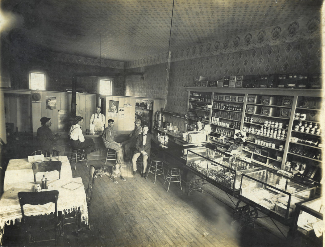
In 1822 a post office was established by the title of Mountain Ridge with John Jones as postmaster. In 1831, it was changed to Pekin, when the prospects of a village were flattering and hopes of future prosperity attracted business enterprise. Divided by the town lines between Cambria and Lewiston, business operations commenced on both sides. Jones opened a store on the Lewiston side. John Cronkite erected a large hotel and Benjamin Thrasher a smaller one. Cronkite was also largely engaged in the mercantile business and had an extensive ashery. James McBain kept a dry goods and grocery store. Josephus Taylor started a store on the Lewiston side. Calvin Hotchiss in 1832 supplied a store in the building put up by him and was later the tavern of George Beber. On the Lewiston side, a grocery, hardware store and tin shop were combined with the post office kept by E. H. Cox. On the Cambria side there were two general stores and three blacksmith shops.
The first burying ground, located on the east side of the street in the village, was appropriated by Samuel Carney, and ultimately deeded by William Carney, John Jones and William Earl, trustees of Elam Carney, to the town of Cambria about 1830. As near as can be ascertained, the ground was first occupied in 1817. Henry Dill was the first person interred.
The land upon which the cemetery of the Mount View Rural Association is located was originally owned by Amos H. Pyle. The organization took place April 20, 1864. Pyle conveyed to the trustees, John Robinson, Lee R. Sanborn, Abraham Le Van, Amos H. Pyle, Thomas Root and Sumner Burns.
Elias Rose built a grist-mill, one and a half miles east of Pekin, which was depended upon by a large extent of the country.
Major John Beach built a saw-mill on Cayuga Creek, one mile from the head, the first that was built in that locality. Cayuga Creek heads in a march one mile from the south line of the town, and two miles from the west.
Thomas Comstock located on the Pekin Road, one mile west of the railroad junction, in 1822, purchasing one hundred acres of the Holland Land Company. He moved from Susquehanna with an ox team. The Comstock cheese factory was established on the farm as a private enterprise in 1848.
Churches of Ridge Road
There are four churches located upon the ridge in the present boundary of Cambria. The Methodist was the first built now existing.
Near the middle of the Ridge stands a handsomely constructed cobblestone edifice upon a gravel bank elevation. It was built in 1845 on land donated by Reuben Wilson.
Near the west end of the ridge, the churches form a cluster. The First Universalist Society of the Town of Cambria was organized in 1867, consisting of 35 members. The church lot was a donation by H.C. Denison, and a brick church was erected in 1868, costing $6,000.
In close proximity, on the north side of the street, stands a neatly arranged, unpretending Catholic church. Opposite it is a German Lutheran church.
The cemetery of the North Ridge Burying Ground Association is located on the same elevated ground, in the rear of the Universalist church. The first grant of two acres was by deed of gift from Harry C. Denison and wife. The first burial was that of Mrs. Timothy Tuttle.
North of this, near the west termination of the North Ridge, there was during early settlement a limestone quarry, available to quite an extent for the building of fire-places and other uses. It was a deposit in regular layers, that were taken out in blocks of required sizes, and the only one that existed between the mountain ridge and the lake. The stone has long since been entirely exhausted.
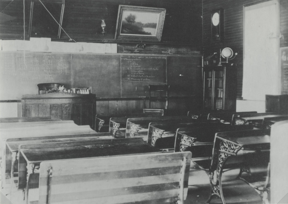
Early Schools
The first school established, other than the Indian mission, which provided for the white children as well as for the Indians until other schools were started, was kept in a log house on the ridge west of Howell’s creek. Mrs. Neal was the teacher. It was one of the buildings that had been temporarily used for an arsenal in the War of 1812. The first framed schoolhouse was built opposite. District No. 2 was the next formed, midway between Warren’s and Molyneaux’s Corners, a log schoolhouse was built in 1815 and kept by a Scotchman named Watson. At Molyneux’s Corners the first schoolhouse was built in 1819, in district No. 2; it was soon after burnt. A disagreement caused the district to be abandoned, the district at Warren’s Corners was set off as No. 2, and the former No. 2 was made No. 10.
Mr. George P. Rose states that the first schoolhouse in Pekin was built on the brow of the hill, at the northeast corner of the mountain road and the one leading to the ridge. It was a log structure fifteen feet by twelve feet. Meetings were held in the same house.
The First Congregational Church of Cambria was organized in the year 1817, by Rev. David M. Smith, the pastor of the then Congregational Church of Lewiston. The original members were Josiah Owen, Susan Owen, Thomas Chamberlain, Jonas Chamberlain, Rachel Mills, and Hannah Crocker. In one year, their numbers had increased to 23.
It was through Mr. Smith that the Holland Land Company granted one hundred acres of land to this church as being the first organized church in Cambria. The land was situated in what is now the town of Lockport, near the present city limits. In 1827 it was sold by vote of the society, and the avails applies to the purchase of land nearer the center of the town.
The church had no resident pastor till 1827 and had only occasional preaching; at first by Rev. James C. Cram, who was the missionary of the American Board of Foreign Missions to the Tuscarora Nation, on their reservation, a little west of the town.
On the 7th day of May, 1824, the ecclesiastical society in connection with the church was formally organized by the adoption of a constitution. Josiah Owen was the first chairman of the society meetings, and Eliakim Hammond, Wiley Bancroft, Joash Taylor, Luther Crocker, Thomas Chamberlain and John Miles Jr. were trustees, with Thomas Webber as clerk and William Scott as treasurer.
Previously to 1836 the church had no house of worship. Meetings were geld in the schoolhouse or in private houses, according to convivence, and during the ministry of Rev. Hiram Hasey, previously to the erection of their church edifice and by the generosity of William Scott, they occupied the hall of his tavern at Cambria Center for all church meetings. At length, however, they erected a house of worship, and dedicated it on March 1st, 1836. This they occupied until October 1877. At that time the society, at a special meeting appointed for the purpose, resolved to remodel and modernize the meeting-house. The work was carried on and completed during the following winter, and on April 2, 1878, the new church was dedicated with appropriate services; Rev. Myron Adams, of Rochester, preaching the sermon, and Rev. I. R. Bradnack, a former pastor, offering the dedicatory prayer. The entire cost of remodeling the house was $4,400. The building was raised so as to allow of a good basement for various church purposes; the galleries in the main audience room removed and a vestibule built in the front, so that the present audience room has a seating capacity of three hundred and fifty people. The finish and furnishings are such as to do credit to the church and society.
The southwest part of the town was next in order of settlement. In 1809 John Carney purchased of the Holland Land Company five hundred acres. It encompassed all of the site of Pekin on the east side of the dividing line between Lewiston and Cambria.
Jairus Rose was the next settler, coming from Canandaigua and locating in 1811. His first purchase of the Holland Land Company was six hundred acres, at $4.50 per acre, to which he soon added at $5 per acre enough to make two thousand acres, which would now include the extreme southwest corner of Cambria and southeast corner of Lewiston, being lots 17, 25, 26, 31 and others. He brought his family by ox cart and a one-horse wagon. It took them just over a week with the help of three hired men to make the journey. They came by the way of Rochester, on the Ridge Road to Dickersonville, where the family stopped with a man by the name of Harris, while Rose and his men advanced and put up a log house in just three days. The way had to be cut from Dickersonville up to the mountains, to the small open spot in the woods that indicated the beginning of a proposed road. The fields, in a state of nature, were stocked with forty head of cattle, that had before them a hard winter with the prospect of having to live on twigs of birch and soft maple. There was considerable value in pine timber on the purchase, that was relied upon for several years for building purposes. In 1813 Mr. Rose sowed two acres with apple seeds, thus starting the first nursery in the county. When fit for selling, they were sold for twelve cents each, and taken in all directions to start the first orchards in the county.
In the Indian foray upon the Niagara border in 1813 Mr. Rose was made a prisoner; his horse was taken from him and he was stripped of all of his clothing, except shirt, pantaloons and boots. While his captors were taking off his overcoat, he succeeded, unobserved, in changing his pocket book, containing $400, from the side pocket to his bosom, whence it luckily passed into his boots, which proved to be a safe deposit. Two Indians, one on each side, locked arms with the captive, forcing a slow run the entire five miles to Lewiston, and often accelerating his speed by raps over the head with the handle of a tomahawk and the ramrods of their guns. The party crossed into Canada, where a British government agent by the name of Nellis tried to buy Rose. Three times the bargain was completed and a hundred dollars paid, and as often the Indians failed to give up the prisoner, clamoring for the death of the “Yankee,” whom Nellis was concealing in a garret, denying his whereabouts. Finally, extorting another hundred, the Indians went off and got drunk. Then they returned and threatened the life of Nellis if the prisoner was not surrendered to them. He was not, however, after six weeks confinement, receiving his food during the time through a scuttle, Rose was sent in care of a private escort of soldiers to Buffalo, from where he joined his family in Canandaigua. They returned after the war and resumed development of their lands.
Myron Orton was born September 20, 1784. He was married to Mary Hoyt, of St. Albans, Vt., in 1811, and moved into St. Lawrence County, N.Y., where he practiced medicine until the War of 1812 caused him to flee to Middlebury. In March of 1815, he moved to Cambria. He was one of the founders of the Niagara County Medical Society and then in later years devoted himself to agricultural pursuits.
William Crosier was a leading citizen for over sixty years. He was a pioneer school teacher in the town of Cambria, the district of his labor for several years spreading over a large portion of the town. He located in 1821 on a farm one and a half miles east of Pekin village.
In 1822 a post office was established by the title of Mountain Ridge with John Jones as postmaster. In 1831, it was changed to Pekin, when the prospects of a village were flattering and hopes of future prosperity attracted business enterprise. Divided by the town lines between Cambria and Lewiston, business operations commenced on both sides. Jones opened a store on the Lewiston side. John Cronkite erected a large hotel and Benjamin Thrasher a smaller one. Cronkite was also largely engaged in the mercantile business and had an extensive ashery. James McBain kept a dry goods and grocery store. Josephus Taylor started a store on the Lewiston side. Calvin Hotchiss in 1832 supplied a store in the building put up by him and was later the tavern of George Beber. On the Lewiston side, a grocery, hardware store and tin shop were combined with the post office kept by E. H. Cox. On the Cambria side there were two general stores and three blacksmith shops.
The first burying ground, located on the east side of the street in the village, was appropriated by Samuel Carney, and ultimately deeded by William Carney, John Jones and William Earl, trustees of Elam Carney, to the town of Cambria about 1830. As near as can be ascertained, the ground was first occupied in 1817. Henry Dill was the first person interred.
The land upon which the cemetery of the Mount View Rural Association is located was originally owned by Amos H. Pyle. The organization took place April 20, 1864. Pyle conveyed to the trustees, John Robinson, Lee R. Sanborn, Abraham Le Van, Amos H. Pyle, Thomas Root and Sumner Burns.
Elias Rose built a grist-mill, one and a half miles east of Pekin, which was depended upon by a large extent of the country.
Major John Beach built a saw-mill on Cayuga Creek, one mile from the head, the first that was built in that locality. Cayuga Creek heads in a march one mile from the south line of the town, and two miles from the west.
Thomas Comstock located on the Pekin Road, one mile west of the railroad junction, in 1822, purchasing one hundred acres of the Holland Land Company. He moved from Susquehanna with an ox team. The Comstock cheese factory was established on the farm as a private enterprise in 1848.
Churches of Ridge Road
There are four churches located upon the ridge in the present boundary of Cambria. The Methodist was the first built now existing.
Near the middle of the Ridge stands a handsomely constructed cobblestone edifice upon a gravel bank elevation. It was built in 1845 on land donated by Reuben Wilson.
Near the west end of the ridge, the churches form a cluster. The First Universalist Society of the Town of Cambria was organized in 1867, consisting of 35 members. The church lot was a donation by H.C. Denison, and a brick church was erected in 1868, costing $6,000.
In close proximity, on the north side of the street, stands a neatly arranged, unpretending Catholic church. Opposite it is a German Lutheran church.
The cemetery of the North Ridge Burying Ground Association is located on the same elevated ground, in the rear of the Universalist church. The first grant of two acres was by deed of gift from Harry C. Denison and wife. The first burial was that of Mrs. Timothy Tuttle.
North of this, near the west termination of the North Ridge, there was during early settlement a limestone quarry, available to quite an extent for the building of fire-places and other uses. It was a deposit in regular layers, that were taken out in blocks of required sizes, and the only one that existed between the mountain ridge and the lake. The stone has long since been entirely exhausted.
Early Schools
The first school established, other than the Indian mission, which provided for the white children as well as for the Indians until other schools were started, was kept in a log house on the ridge west of Howell’s creek. Mrs. Neal was the teacher. It was one of the buildings that had been temporarily used for an arsenal in the War of 1812. The first framed schoolhouse was built opposite. District No. 2 was the next formed, midway between Warren’s and Molyneaux’s Corners, a log schoolhouse was built in 1815 and kept by a Scotchman named Watson. At Molyneux’s Corners the first schoolhouse was built in 1819, in district No. 2; it was soon after burnt. A disagreement caused the district to be abandoned, the district at Warren’s Corners was set off as No. 2, and the former No. 2 was made No. 10.
Mr. George P. Rose states that the first schoolhouse in Pekin was built on the brow of the hill, at the northeast corner of the mountain road and the one leading to the ridge. It was a log structure fifteen feet by twelve feet. Meetings were held in the same house.
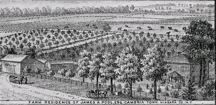
Source: History of Niagara County, N.Y, with illustrations descriptive of its scenery, private residences, public buildings, fine blocks, and important manufactories, and portraits of old pioneers and prominent residents. New York: Sanford & Co., 36 Vesey Street.
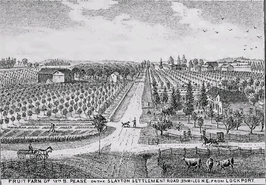
Source: History of Niagara County, N.Y, with illustrations descriptive of its scenery, private residences, public buildings, fine blocks, and important manufactories, and portraits of old pioneers and prominent residents. New York: Sanford & Co., 36 Vesey Street.